Blank Map of Asia
Free printable Asia map with 49 countries. Four variants — blank, labeled, colored, and with cities. Download as SVG, PNG, or PDF. Public domain.
About this blank map of Asia
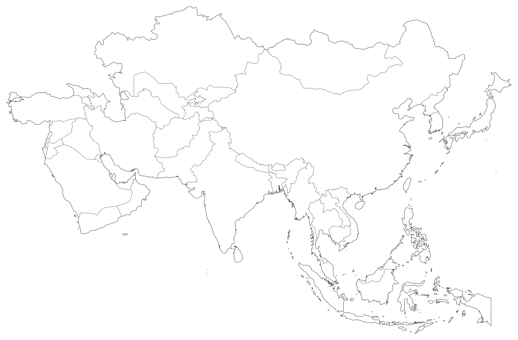
This is a free, high-resolution blank outline map of Asia, showing all 49 countries. It is rendered fresh from public-domain boundary data (US Census Bureau via us-atlas or Natural Earth 1:50m) and exported as clean vector paths — no watermark, no signup, and no attribution required.
Asia is home to approximately 4.78 Billion (2025 UN Estimate) and covers 44,579,000 km² (17,212,041 mi²).
All four variants are generated from the exact same source geometry, so the borders align with sub-millimeter precision between them. You can download the blank version for student worksheets, then print the labeled version as the grading answer key — knowing each polygon will sit in the identical position on paper.
Asia factsheet
| Type | Continent / Global |
| Continent / Region | Asia |
| Population | 4.78 Billion (2025 UN Estimate) |
| Surface Area | 44,579,000 km² (17,212,041 mi²) |
| Population Density | 107 / km² |
| Countries | 49 |
| Recommended Projection | Asia Lambert Conformal Conic |
| Highest Elevation | Mount Everest, Nepal/China (8,848 m / 29,029 ft) |
| Lowest Elevation | Dead Sea, Jordan/Israel (-430 m / -1,411 ft) |
| Primary Waterway | Yangtze River (6,300 km) / Yellow River / Ganges / Indus |
| Time Zones | UTC+2:00 (Middle East) to UTC+12:00 (Kamchatka) |
The 4 variants explained
We generate four versions of every map from the same source geometry. Pick the one that fits your project — and remember, every variant is downloadable as SVG, PNG, or PDF.
1. Blank outline
The basic outline. Every countrie is shown as a separate vector path with no fill, just a thin border. This is the version you want for tests, fill-in-the-blank homework, or as a starting point for your own custom GIS overlay.
2. Labeled
Same outline, but with the countrie names placed cleanly at each geographic centroid. Use this version as the classroom answer key or for fast visual reference when you don't have time to add labels yourself.
3. Colored
Each jurisdiction is filled from an ink-saving 12-color pastel palette so that adjacent territories contrast clearly. The colors are arbitrary and non-political — use this when you want an immediate, vibrant layout without manual coloring.
4. With cities
The outline plus anchor dots and typographic labels for top major metropolitan centers and the capital. Ideal for travel projects, economic corridors, or wherever readers require urban navigational anchors.
What people use blank maps of Asia for
K-12 and university teaching
Geography, history, and social studies instructors use blank maps of Asia for quizzes (“label the countries”), homework worksheets, and unit-assessment answer keys. The blank/labeled pair ensures the questions and solutions line up identically.
YouTube and content creation
Video essayists and documentarians use the colored or cities variant as vector base layers in After Effects, DaVinci Resolve, or Premiere. Because SVG is purely mathematical, you can scale into regional close-ups in 4K resolution with zero pixelation.
Sales and marketing territory mapping
Businesses use blank maps to plan distributor territories, franchise coverage, or logistics routes. Open the SVG in Figma or Adobe Illustrator, drop colored fills onto target zones, and generate an executive-ready territory slide in minutes.
Data visualization and choropleths
Data journalists and GIS analysts use our clean SVG geometry for choropleth maps. Each boundary path contains a stable ID, making it straightforward to shade by population, economic indicators, or climate data using D3.js, Observable, or Python.
Travel scrapbooks and bucket lists
Travelers print a blank map of Asia and shade each region as they visit. By the end of a trip, you have a personalized physical keepsake without third-party tracking or subscriptions.
Classroom ideas for the Asia blank map
A blank map is a Swiss-army knife for geography education. A few exercises that work across elementary through college curricula:
- Label race: Print the blank version, give students 10 minutes to write down as many countries as they can recall, and grade against the labeled variant.
- Color by region: Group countries by climate, economic output, or historical development and have students construct a legend.
- Population dot map: Have students place dots proportional to regional population density to visualize demographic concentration.
- Current events tracker: Have students place pins or stickers on regions highlighted in weekly news reports.
- Expedition planner: Map historical exploration routes or modern interstate freight corridors across the terrain.
How to print the Asia map
For most home and classroom users, the PDF option is easiest. Download the PDF, open it in your viewer, and hit print with “Scale to fit” enabled. The file is sized to fill US Letter and A4 pages with balanced margins.
For best print quality
Use the vector SVG or PDF files — both preserve continuous curves at any scale. If using PNG, choose the 2,400 px Print or 4,800 px Poster resolution to prevent pixel blurriness on paper.
For poster and large-format printing
Take the vector SVG or PDF to any print shop. Because vectors have no resolution ceiling, a single file prints with identical razor sharpness at 8.5″ × 11″ or 36″ × 48″ wall-poster dimensions.
Asia countries list
| Subdivision | Code | Capital / Seat | Classification |
|---|---|---|---|
| China | CN | Beijing | 1.41 Billion |
| India | IN | New Delhi | 1.43 Billion |
| Indonesia | ID | Jakarta / Nusantara | 278M |
| Pakistan | PK | Islamabad | 240M |
| Japan | JP | Tokyo | 124M |
| Saudi Arabia | SA | Riyadh | 36M |
Creative Commons CC0 1.0 Universal License
This map and its vector boundary coordinates are dedicated to the public domain worldwide under CC0. You can copy, modify, distribute, publish, and commercialize the work without asking permission and without any requirement for attribution.
Cartographic glossary
Vector files (SVG/PDF) use geometric coordinates that never lose quality when scaled. Raster files (PNG/JPEG) store fixed grids of pixels that blur when enlarged.
A mathematical formula that translates Earth's curved 3D surface onto flat 2D paper while managing distortions in area, distance, and direction.
The calculated geographic center of mass of a polygon, used by cartographers to place region labels with optimal visual balance.
Measure of print resolution. 150 DPI is standard for student handouts; 300 DPI delivers continuous photo-quality sharpness for publications.
Frequently Asked Questions: Asia Blank Map
Authoritative People Also Ask answers regarding printable blank maps of Asia, administrative boundaries, vector editing, and commercial licensing.
Yes. Southwest Asia (the Middle East), including the Arabian Peninsula, Levant, and Iranian plateau, is fully included.